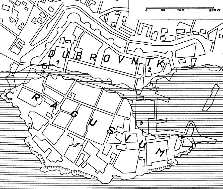
This map explains why a medieval city could sport such a wide street. It started as two towns: the Roman Ragusium (Ragusa) at bottom -- an island separated from the Slavic Dubrovnik. An extraordinary bit of 12th century civil engineering filled in the channel and left space for the long Placa (Stradun) and the wide expanse in front of the Rector's palace -- #3 on the above map. (Thanks to F. W. Carter for this map.)
First | Previous Picture | Next Picture | Last

